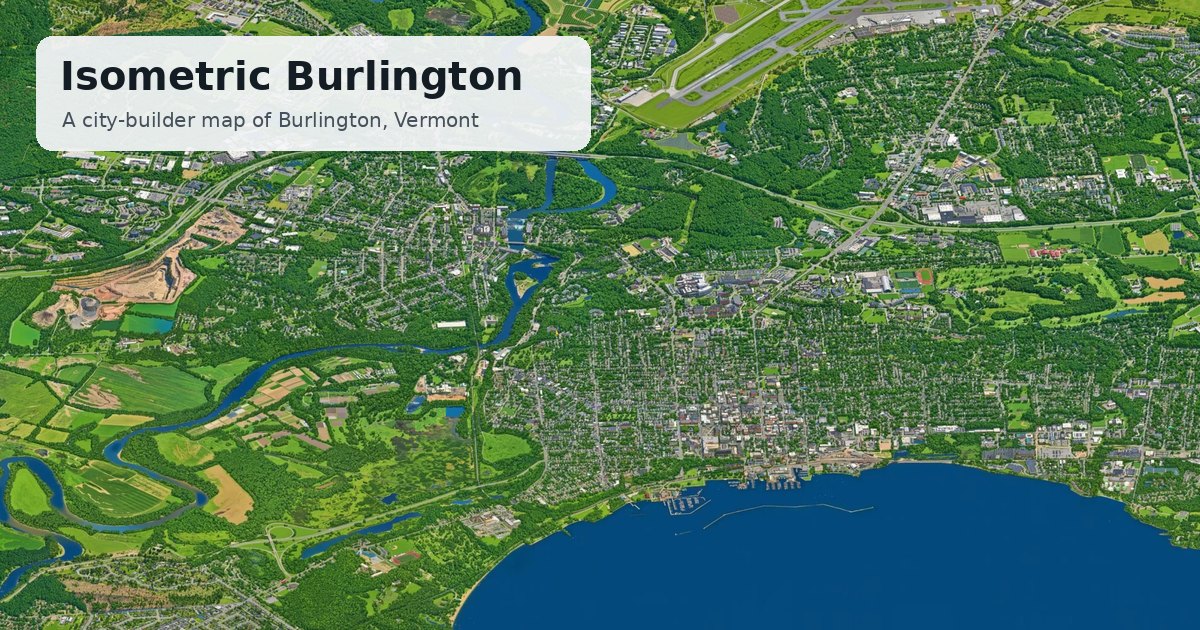
AI-drawn isometric map of Burlington, South Burlington and Winooski lets users explore streets, weather and transit.
Isometric Burlington presents a town-scale illustration redrawn by an open-source AI image model. The map covers the area of Burlington, South Burlington and Winooski, Vermont, rendered in a city-builder style from Google's 3D imagery. Every block was drawn by the model, meaning small details are invented and may not match reality. The sky reflects Burlington's real-time sunset and current weather at BTV. Buses follow Green Mountain Transit's published timetable, and planes show live ADS-B positions. Users can drag to move, scroll to zoom, and tap bus or plane icons for route or flight details. A time-of-day toggle switches between day, night, weather layers and transit modes.
About Isometric Burlington: Burlington, South Burlington and Winooski, Vermont, drawn as an isometric city map you can turn, with the real sunset and live weather. More at isoburlington.com.